Bayram Cigerli Blog

Bigger İnfo Center and Archive
  • Herşey Dahil Sadece 350 Tl'ye Web Site Sahibi Ol

    Hızlı ve kolay bir şekilde sende web site sahibi olmak istiyorsan tek yapman gereken sitenin aşağısında bulunan iletişim formu üzerinden gerekli bilgileri girmen. Hepsi bu kadar.

  • Web Siteye Reklam Ver

    Sende web sitemize reklam vermek veya ilan vermek istiyorsan. Tek yapman gereken sitenin en altında bulunan yere iletişim bilgilerini girmen yeterli olacaktır. Ekip arkadaşlarımız siziznle iletişime gececektir.

  • Web Sitemizin Yazarı Editörü OL

    Sende kalemine güveniyorsan web sitemizde bir şeyler paylaşmak yazmak istiyorsan siteinin en aşağısında bulunan iletişim formunu kullanarak bizimle iletişime gecebilirisni

Bahrain etiketine sahip kayıtlar gösteriliyor. Tüm kayıtları göster

Bahrain - Old Photographs (Part I)

Below is a collection of stunning old photographs of Bahrain taken in the 20th century. I'll try to input as many captions as I can. Enjoy!

(The vast majority of these photographs were taken prior to the 1960s, by which time their copyright expired and is now in the public domain, as stated in Legislative Decree No. 10 of June 7, 1993 in respect of Copyright Law)


Bab al Bahrain
RAF Muharraq airbase, in 1949.
Farooq house - Now Ibn Sina health centre.
Awal Cinema, circa 1950s.
House of the poet Abdul Rahman Rafea, in the Fadhel neighborhood of Manama
House of Mustafa bin Abdullatif in Ras Ruman, close to Manama.
Shaikh Hamad's palace in Gudaibiya, Manama.
The Manama Municipality, 1930-1950s.
Entrance to Manama Souq, 1949.
Manama's northern sea coast

Ardha Dance in front of Sheikh Hamad Palace

Ardha Dance in front of Riffa Palace

Al Ahli Club in the 1960s.
Customs Building and the main seaport in Manama
Government street, Manama.
Bab al Bahrain road
Wednesday Market in Manama (happened every Wednesday, hence the name)
Vegetable Market in Manama 1930s-ish
Opening of the Al Tajer library in Hoora, in 1920.
Muharraq in the 1930s.
British Political Agency in Manama, 1900ish
Freezing conditions in Awali, Bahrain on 20 of January 1964
Market
Liwa dance in Bahrain, a traditional Bahrain music that originated from Africa
Al Fadhel mosque in Fadhel neighbourhood of Manama
Aerial view of Manama, circa 1950s.
Another aerial view of Manama
Old customs office, circa 1940s.
Manama souq, circa 1930s.

The Bombing of Gulf Air Flight 771

Gulf Air Flight 771 was a regularly scheduled flight from Karachi, Pakistan to Abu Dhabi, United Arab Emirates. On 23 September 1983, while the Boeing 737-2P6 was on approach to Abu Dhabi International Airport, the airplane "suddenly lowered its altitude" abruptly and crashed 30 miles north-east of the airport, near Mina Jebel Ali in the emirate of Abu Dhabi. All 110 people on board, including 5 crew members, died.
The plane crashed near Mina Jebel Ali
 In the aftermath of the incident, an anonymous Gulf Air official stated that "the airliner crashed due to an accident in midair" and declined to elaborate. Karachi's airport control tower was said to have received a distress call from the ill-fated plane, minutes prior to its crash. [1]

What happened?

An investigation was carried out by the American National Transportation Safety Board, and they released a 400-page report on their findings, which was not immediately published in the Gulf. The report was revealed in September 1987 by British politician Sir Dudley Smith, under pressure from the parents of British stewardess Lyn Farthing who perished in the crash. Others among the crew on board included British stewardess Sally Anne of Peterborough and Bahraini steward Hashim Sayed Abdullah.

A Gulf Air Boeing 737-2P6
The report included last moments in the cockpit, including a description of Omani captain Saoud Al Kindy praying as the plane nose-dived into the desert. Also on the flight deck was Bahraini co-pilot was Khazal Al Qadi. The report mentioned that everything on board the flight was perfectly normal and voice transcripts showed the crew chatting among themselves. One asked the other if he was on duty the next day, to which he replied "No, I've got a day off tomorrow". That was followed by a sudden interruption and the recording showed the pilots making a frantic attempt to control the plane.

The report indicated a bomb in the baggage hold as the primary cause of the accident, due to the following factors:
  1. A passenger who checked in baggage at Karachi but never boarded the plane.
  2. The nature of injuries to passengers who were seated above the baggage hold.
  3. A sudden interruption to an otherwise normally operating flight.     
  4. Data obtained from the aircraft's flight data recorder.
Who bombed Gulf Air Flight 771?

Evidence points to Abu Nidal, a radical Palestinian extremist and head of the militant Palestinian splinter group also known as the Abu Nidal organization.

Casualties:

105 passengers and 5 crew members were on the airplane. All 110 died. 96 Pakistanis (most of whom were returning from spending Eid holidays in their native Pakistan), 7 Britons, One American and one Iranian.

Gulf Daily News' frontpage on after the crash


Matam al Ajam al Kabeer - A short history

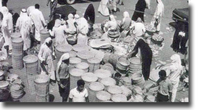
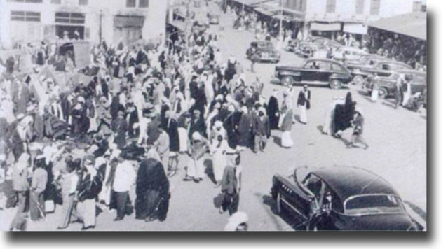
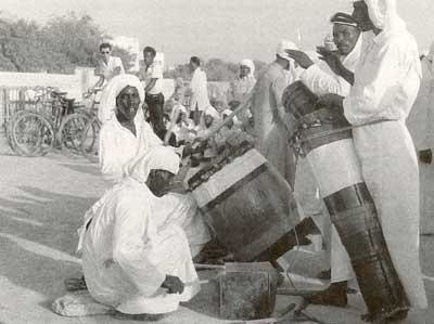
 Since it is the month of Muharram over here in Bahrain, the processions of Muharram are ongoing. For those who are not aware, Muharram is a month of mourning for Muslims of the Shia sect, and commemorates the death of Imam Hussain.

These processions have quite a history in Bahrain, occurring annually for the past centuries. These processions are organised by matams (or husseinya, as they are sometimes called), which are congregation halls. At least one matam exists in each village in the country, and these matams are numerous, especially in the old districts of Manama. The primary focus of this post is on a particular matam; Matam Al Ajam al-Kabeer.

(I wrote this part on Wikipedia already)

 The Matam:

Matam Al-Ajam Al-Kabeer (Arabic:مأتم العجم الكبير) is the first Ajam (who are Persians in Bahrain) matam in Bahrain. The matam was founded in the Fareej el-Makharqa by Abdul Nabi Al Kazerooni, a rich Persian merchant. Himself an immigrant from the Dashti region of Iran, he organised processions, collected donations and hired orators (Arabic: خطيب‎) to speak at the matam.

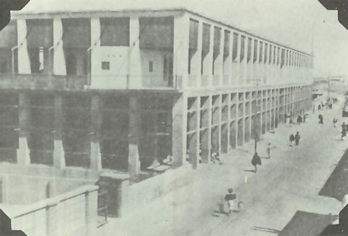
Construction started in 1882 as a specialized building where Ashura, a holy day in Shia Islam, would be marked with processions, ceremonial flagellation and passion plays commemorating the death of Imam Hussain.
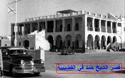
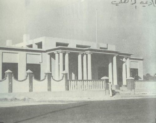
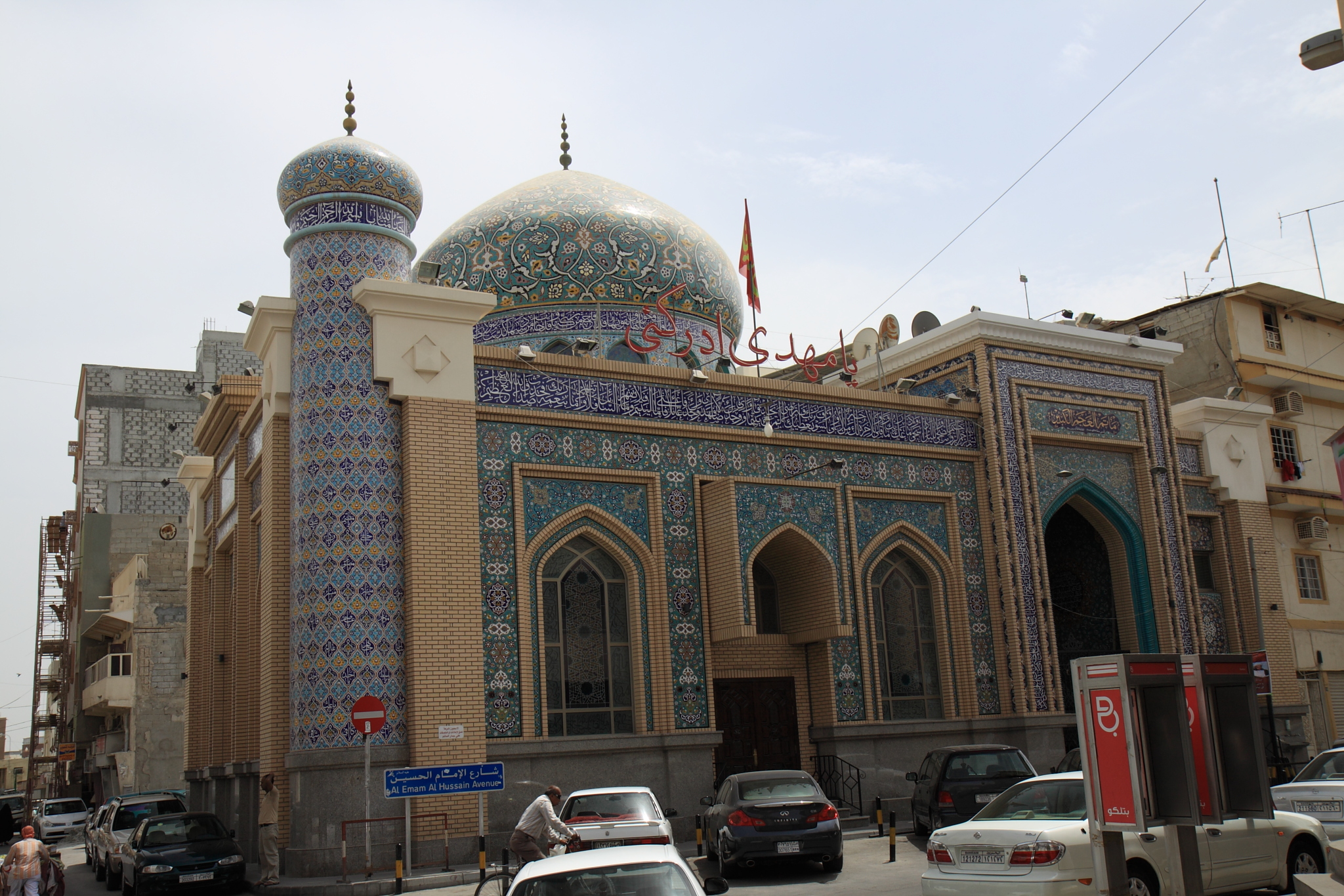
Exterior of the matam
The matam is still used for this purpose.  It was originally built with simple construction material such as palm tree trunks and leaf stalks. The matam was formally established in 1904 where it was decided that the matam would be renovated with rocks, clay and cement. Initially in the 1890s, the matam was primarily supported by Persian merchants, with two-thirds of the donation coming from the Bushehri and Safar family, respectively.

 For much of the 20th century, the matam had relied on yearly donations of money and land from rich and poor members of the Persian community and from waqf revenue.The matam also had an emergency relief fund that was to be distributed to the poor and to needy individuals; the matam provided financial aid and shelter to people following the collapse of the pearling market in the 1930s.

Upon the death of Abdul Nabi Al Kazerooni in 1927, Abdul Nabi Bushehri, himself a Persian immigrant from Bushehr and a well-respected figure in the Persian community, took control of the matam. Unlike Kazerooni, Bushehri ran the matam with other notables of the Persian community, forming a de facto board.

Upon Bushehri's death in 1945, the board took over. In order to prevent confusion, the board appointed Hasan Baljik, himself a member, as the budget and procession organiser. In 1971, an administrative board consisting of a president, vice president, secretary, treasurer and others was set up, all of whom were rich merchants. By 1952, the matam was supported by the rent of 3 houses, 6 shops and a hawla.
The interior of Matam al Ajam al Kabeer, in 2008

For further reading, I strongly recommend reading Mapping the Transnational Community: Persians and the Space of the City in Bahrain, c. 1869-1937, by Nelida Fuccaro. It provides an excellent overview and is one of the scarce resources available on this topic. And Khuri's Tribe and State in Bahrain.

Vintage Maps of the Arabian Peninsula

Some rather old maps of the Arabian peninsula, details under each respective map.

It's bigger when you click it !
Embedded text: This map of the Arabian Peninsula, published in 1720, shows Arabia Felix, Arabia Deserta, and Arabia Petraea. Other regions included are Palestine, Mesopotamia, Chaldea, Persia, Aegyptus, and Aethiopia. A large number of towns are shown. The title cartouche includes nine vignette coins. The tribal and town names on the map are those used by Ptolemy. Some are used more than once, with variations. Thus “Indicara,” “Iacara,” “Ichara,” and “Aphana” all could indicate the same place: the spot where Alexander the Great intended to build a capital on an island in the Arabian Gulf, enabling him to control the trade of the region and extend his empire (a scheme that he was unable to accomplish before he died).

 Archeological research suggests that this place was Failakah Island in present-day Kuwait, although some historians place it at Abu Ali Island. The map shows a peninsula near present-day Bahrain. The islands of “Arathos” and “Thylaso” indicate Muharraq and Bahrain islands, respectively, which are actually located north of Qatar. On this map, they are placed on the Persian coast side, probably because the cartographer confused them with “Hormuz” and “Qishm.” Qatar is mentioned on the map as “Catara,” but its shape and location are not accurate. The map is by Christoph Weigel, a German engraver, art dealer, and publisher.

Embedded text: This map from Ptolemy’s Geographia was published in 1578 and reprinted on many occasions between 1584 and 1704. It is much more finely engraved than maps in previous Ptolemy editions. The map mentions several places in present-day Qatar (Abucei, Leaniti, Themi, Asateni, and Aegei). Names added to this edition of the map include Mesmites Sinus, Idicar, and a second Idicar, located in present-day Kuwait. This name is similar to the island of “Ichara” found near Magorum Sinus. Contemporary research has confirmed that Kharj is the island known to the ancients as “Icara.” 
One of the major peninsulas shown on the map is named “Chersonesi Extrema,” near Catara. Modern scholarship has identified Chersonesos as Ras Rakn in present-day Qatar. Ichtyophagorium Sinus is the gulf inhabited by the people identified in ancient histories as the “Fish Eaters.” Claudius Ptolemaeus, known in English as Ptolemy, was an ancient mathematician, astronomer, geographer, and astrologer who was born sometime after 83 A.D., most likely in a town in the Thebaid called Ptolemais Hermiou in Roman Egypt. He lived in Egypt and died in Alexandria around the year 168.

Embedded text:  This 1616 map is a reprint of a map originally published in 1598 by Jodocus Hondius (1563-1612), a Flemish cartographer and engraver who settled in Amsterdam in about 1593 and established a business that produced globes and the first large maps of the world. The map covers the territory from west of the Gulf of Suez to the eastern side of the Arabian Peninsula, and from the mouth of the Euphrates River to Aden. The only cities indicated on the western coast of the Persian or Arabian Gulf are Qatar (“Catara”), “Godo,” and “Catiffa.”

 The map shows sandbanks around the coast and rivers at Medina and Mecca. Few towns and regions are shown, and there is a range of mountains in the center of the peninsula. Al Qatif is repeated as the town “Catiffa” and the region “Elcatif.” The peninsula opposite Bahrain Island, shown unnamed, is marked as where “Catara” is found. The commonly noted rivers of the Arabian coast are shown as very close together. The Arabian Gulf is called “Persicus Sinus” (Persian Gulf) and there is no name given for the Red Sea. The Ayaman area is shown as the most populated area on the map. The cartographer uses castles to denote cities and dotted lines to show the division of the Arabian Peninsula into three parts.
(Click for larger image)
 Embedded text: A beautiful example of Rigobert Bonne's 1771 decorative map of the Arabian Peninsula. Covers from the Mediterranean to the Indian Ocean and from the Red Sea to the Persian Gulf. Includes the modern day nations of Saudi Arabia, Israel, Jordan, Kuwait, Iraq, Yemen, Oman, the United Arab Emirates, and Bahrain. Names Mt. Sinai, Mecca and Jerusalem as well as countless other cities and desert oases. Also notes numerous offshore shoals, reefs, and other dangers in the Red Sea and the Persian Gulf. There is a large decorative title cartouche in the upper right hand quadrant. A fine map of the region. Drawn by R. Bonne in 1771 for issue as plate no. A 25 in Jean Lattre's 1776 issue of the Atlas Moderne .

Embedded text: A fine example of Rigobert Bonne and G. Raynal’s 1780 map of the Arabia and Abyssinia (Ethiopia). Covers from the Nile Delta south as far as the Horn of Africa and West to Persia, inclusive of the modern day countries of Ethiopia, Egypt, Saudi Arabia, Yemen, Oman, Kuwait, the and the United Arab Emirates. Offers surprising detail considering that his part of the world was largely unknown to Europeans.

 Identifies towns, rivers, some topographical features, ports and political boundaries. Dangerous reefs and other undersea dangers that historically hindered trade in the Red Sea and the Persian Gulf are tentatively ghosted in. Drawn by R. Bonne for G. Raynal’s Atlas de Toutes les Parties Connues du Globe Terrestre, Dressé pour l'Histoire Philosophique et Politique des Établissemens et du Commerce des Européens dans les Deux Indes .

(Click for larger image)
 Embedded text: A particularly interesting historic map, this is Karl von Spruner’s 1865 rendering of Arabia, Aethiopia (Ethiopia) and Egypt (Aegyptus) in antiquity. Centered on the Red Sea or Mare Rubrum , this map covers the entirety of the Arabian Peninsula, the Persian Gulf, and the Nile Valley as far south as Lake Tana (Pseuba), the source of the Blue Nile. Like most of Spruner’s work this map overlays ancient political geographies on relatively contemporary physical geographies, thus identifying the sites of forgotten towns and villages, the movements of armies, and the disposition of lands in the region. This particular example includes both ancient Latin and more contemporary Arabic names (transliterated of course) for many important regions and sites.

 Additionally, two inset maps are offered. In the lower left hand quadrant a map labeled “Heptanomis et Thebais” focuses on the course of the Nile from Heptatnomis (near Fayum) south to just past modern day Aswan, covering in the process many of the ancient Egyptian cities now submerged under the waters of Lake Nasser. Another inset, in the upper right quadrant, focuses on the fertile Nile Delta, forming an inverted triangle between Alexandria, Memphis, and Casluch. As a whole the map labels important cities, rivers, mountain ranges and other minor topographical detail. Territories and countries outlined in color. The whole is rendered in finely engraved detail exhibiting the fine craftsmanship for which the Perthes firm is known

(Click for larger image)
 The Arabian Peninsula by Nicolaus Germanus in 1467

Map of the location of Arab tribes in 600 AD
(Click for larger image)
  • Title:Arabia Felice Nuova Tavola
  • Made in Venice
  • FIRST EDITION 1561
  • SIZE 18.0 x 24.7 cms
  • TECHNIQUE Copper engraving
(Click for larger image)

Embedded text: Map of Persia and Arabia from J. H. Colton’s 1855 Atlas of the World. Covers Afghanistan, Iran, Iraq, Jordan, and the Arabian peninsula ( Saudi Arabia, Yemen, Kuwait, United Arab Emirates, and Oman). Map is a lithograph from a steel plate engraving. Details desert trading routes, oases, trading centers, etc. Beautiful hand color